
Airwise Solutions and UAS Sentry Integrate Drone Detection with Airspace Intelligence
Partnership brings Remote ID detection into a common operating picture for critical infrastructure, public safety and enterprise users.
Airwise Solutions and UAS Sentry have formed a partnership focused on low-altitude airspace awareness. The companies will integrate UAS Sentry Nexus detection capabilities with the Airwise Nexus platform.
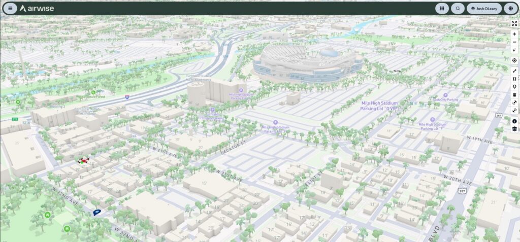
The integration will display detected Remote ID signals alongside an organization’s drone operations. Users can also connect that data with airspace information, mission activity, aircraft telemetry, weather and FAA services.
The companies said the system could support critical infrastructure, utilities, airports and industrial sites. It may also serve public safety agencies and other organizations managing drone operations near sensitive locations.
Adding Context to Drone Detection
UAS Sentry Nexus detects and identifies drones that transmit Remote ID signals. Depending on the broadcast type, Remote ID can provide a drone’s location and control station information.
The Airwise integration adds operational context to that data. Organizations can compare detected drones with approved missions, planned flights and known fleet activity. This may help teams distinguish authorized operations from aircraft that require attention.
“Organizations need visibility into the entire low-altitude operating environment, not just the aircraft they are managing,” said John Powers, Chief Revenue Officer at Airwise Solutions.
“UAS Sentry brings powerful, scalable Remote ID detection into the Airwise Nexus operational picture. By combining detection with airspace management, UTM and enterprise drone operations, we can help organizations move from simply knowing a drone is present to understanding what is happening in their airspace and how it relates to their operations.”
Airwise provides tools for enterprise drone operations and national airspace awareness. Its platform covers mission planning, fleet and pilot management, airspace authorizations, analytics and UAS Traffic Management.
Scalable Remote ID Monitoring
UAS Sentry Nexus can support between three and 18 independently processed antennas through one LAN or LTE connection. Organizations can cover one facility or build a detection network across several sites.
The system provides geofencing, alerts, aircraft classification, analytics and historical reporting. Its open API supports links with third-party command, control, mapping and situational awareness platforms.
“UAS Sentry was designed to make sophisticated Remote ID detection scalable and accessible,” said David Burritt, UAS Sentry. “Integrating our detection data with Airwise puts that information into a broader operational environment. Customers can deploy UAS Sentry where detection is needed today and use Airwise to connect that capability to larger drone and airspace operations.”
UAS Sentry develops its software and firmware in the United States. The company also completes final assembly in the country.
The integration applies to drones that transmit Remote ID signals. It will not detect every aircraft. However, it can give organizations another source of information for monitoring low-altitude activity and managing drone operations.