
GeoCue Unveils TrueView 550 Aerial LiDAR System at INTERGEO
New system combines advanced LiDAR, dual mapping cameras and two positioning options for professional surveying and mapping.
GeoCue has expanded its standard aerial LiDAR portfolio with the launch of the TrueView 550. The company announced the new mapping system at INTERGEO 2026 in Munich, Germany.
The TrueView 550 builds on GeoCue’s TrueView 539 and TrueView 540 systems. It combines high-performance LiDAR with two 20-megapixel mapping cameras. Customers can also choose between two GNSS-inertial navigation systems.
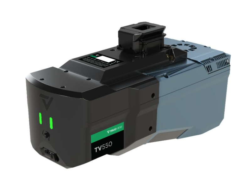
GeoCue designed the system for surveying, engineering and other geospatial applications. It aims to offer performance close to higher-end aerial LiDAR systems at a lower price point.
Longer Range and Higher Data Density
The TrueView 550 supports ranging distances of up to 2,100 meters. Typical flight altitudes range from 100 to 600 meters above ground level.
At 120 meters, the scanner can collect up to one million points per second. Advanced waveform processing supports point-cloud density and data completeness. These capabilities can help operators map larger areas and work over steep or uneven terrain.
“The TrueView 550 is a true GeoCue product made in USA,” said Frank Darmayan, CEO of GeoCue. “We are combining the latest advanced LiDAR technology, GNSS-INS, and dual mapping cameras for a wider Field of View. The result is a completely unique TrueView sensor that gives customers the level of accuracy and performance they expect from an engineering-grade system, but at a much more accessible price point.”
The system includes two 20-megapixel global shutter cameras. Together, they provide a wider imaging field of view than a single-camera system.
The cameras collect RGB imagery while the LiDAR sensor records 3D measurements. This combined data can improve point-cloud colorization and help users identify features. It can also support inspections and the creation of project deliverables.
Potential uses include topographic surveys, infrastructure mapping, corridor projects and construction documentation. The system also connects with GeoCue’s broader workflow. Users can process data, perform quality control and create deliverables in LP360.
Two Positioning Options
GeoCue offers the TrueView 550 with its TrueNav GNSS-inertial navigation system. Customers can also select the Applanix APX-20 for higher positioning performance.
The APX-20 option includes unlimited Trimble PP-RTX post-processing. PP-RTX uses satellite and reference network corrections to provide centimeter-level positioning. This approach can remove the need to establish a field base station.
“The LiDAR market continues to evolve, and our customers have different requirements depending on the projects they are taking on,” said Vivien Heriard-Dubreuil, CEO of mdGroup, GeoCue’s parent company. “With the TrueView 550, we wanted to give customers more choice. They can select our TrueNav positioning system for a powerful, integrated GeoCue solution, or choose the Applanix APX-20 for enhanced GNSS-inertial performance and access to unlimited PP-RTX processing. That flexibility, combined with the performance of the new LiDAR and dual imaging system, makes the TrueView 550 the highest-performing sensor in our standard portfolio.”
Expanding the TrueView Portfolio
The INTERGEO launch follows two GeoCue product announcements at Commercial UAV Expo 2026. At that event, the company introduced the TV1 NDAA UL and TV1 NDAA.
GeoCue developed both systems with Ouster. They use the Ouster OS1 MAX REV8, a 256-channel LiDAR sensor. It can collect up to 10.4 million points per second. Its practical detection range reaches 200 meters at 10% reflectivity.
The lightweight TV1 NDAA UL uses the sensor’s native direct colorization. As a result, it does not need a separate mapping camera to colorize the point cloud. Its size and weight make it suitable for compact multirotor and fixed-wing aircraft.
The TV1 NDAA uses the same LiDAR technology but adds a 26-megapixel global shutter camera. It collects detailed point clouds and high-resolution images during the same flight.
These systems address customers with NDAA compliance requirements. The TrueView 550 serves customers seeking a high-performance option within GeoCue’s standard product range.
“We look for gaps and opportunities where we can better fulfill the needs of our customers and respond to what the market is asking for,” said Vincent Legrand, Vice President of Global Sales at GeoCue. “The TrueView 550 fills an important position in our standard range, just as the new TV1 NDAA systems expanded our compliant range. Having strong options across both our Standard and NDAA-compliant portfolios gives GeoCue the ability to help customers select the right tool for the work they actually need to accomplish.”