
Blue Marble Unveils Global Mapper Subscription Plans
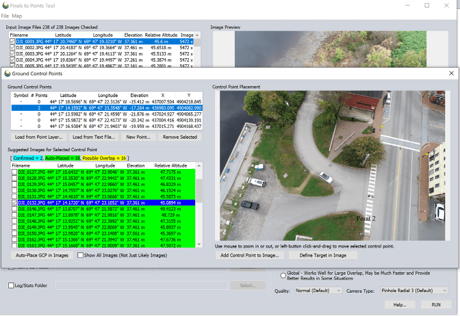
The unified package integrates photogrammetry, lidar processing, terrain analysis, and mapping tools across three distinct subscription levels.
Blue Marble Geographics is launching a subscription-based access model for Global Mapper, consolidating various geospatial services and tools that were once sold individually into one comprehensive solution.
Users can choose from three specific tiers—Essentials, Advanced, and Professional—each designed to address different requirements for data processing and mapping tasks.
This shift replaces the old perpetual license system, which relied on separate maintenance contracts, with annual subscriptions tied to named users. Every tier comes with centralized license management, training materials, technical support, and software updates.
Three Tiers for Different Mapping Workflows
This new framework gives users the flexibility to pick tools that match their particular project needs.
The Essentials tier delivers fundamental GIS functions such as basic data preparation, coordinate transformation, file conversion, and data viewing.
The Advanced tier introduces professional map production, automation, scripting, and vector and terrain analysis. It also bundles Geographic Calculator and MAPublisher, tools that used to need separate purchases, with the latter requiring Adobe Illustrator.
Professional users gain access to AI-assisted image analysis, advanced lidar and point cloud processing, and Pixels to Points photogrammetry. These features enable workflows that convert drone footage into orthorectified images, point clouds, and 3D models.
Drone mapping specialists will find the Professional tier most useful due to its specialized capabilities. Additional features include multispectral imagery support in Pixels to Points, automated tree trunk classification, and live previews for automatic point cloud analysis.
Connecting Office and Field Operations
This subscription launch aligns with Blue Marble’s wider strategy after merging with Avenza Systems in April 2026.
Blue Marble intends to bridge the gap between field operations and desktop GIS processing using Avenza Maps, its mobile mapping app. Upcoming updates aim to enhance data sharing across different work environments and devices.
"Consolidating the office workflow into one subscription and managing it through one administrative portal reduces the complexity of how practitioners access, manage, and use the tools they rely on," said Patrick Stevenson, Chief Product Officer of Blue Marble Geographics.
The Blue Marble Hub centralizes training, support, downloads, seat assignments, and license management. Subscribers are also guaranteed four software releases annually.
Customers with active Maintenance & Support contracts will keep receiving support until those contracts expire, while existing users have the option to move to the subscription model.
For more information, visit Blue Marble’s Global Mapper subscription overview or its guide to choosing a subscription tier.