
NOAA Deploys Autonomous Surface Vehicles to Investigate Hurricane Rapid Intensification
Deployment of Saildrone Explorers for Hurricane Research
Saildrone has announced plans to deploy 10 Saildrone Explorer unmanned surface vehicles (USVs) during the 2026 hurricane season in collaboration with the National Oceanic and Atmospheric Administration (NOAA). This initiative aims to enhance hurricane forecasting and storm research across the Atlantic basin.
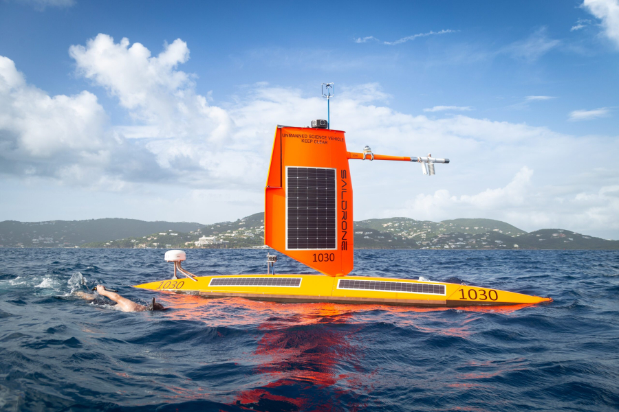
This deployment continues a partnership between NOAA and Saildrone that began in 2021. NOAA scientists will set mission objectives as storms develop, while Saildrone operators will position the USVs to gather real-time ocean and weather data in and around tropical systems.
The Saildrone Explorer vehicles will operate from July through November in the western tropical and subtropical Atlantic Ocean, Caribbean Sea, and Gulf of Mexico. As storms form, the USVs will be positioned to collect data in areas where traditional observations can be challenging or hazardous.
Research Focus on Rapid Intensification
NOAA researchers will utilize the data collected to investigate the transfer of heat, moisture, and momentum between the ocean and atmosphere during storms. This information is expected to enhance forecasting models, particularly for rapid intensification events.
Rapid intensification is defined as an increase in a hurricane’s maximum sustained winds by at least 30 knots (35 mph) within a 24-hour period. Accurately predicting these events remains a significant challenge for meteorologists.
Greg Foltz, an oceanographer at NOAA and a principal investigator on the mission, stated, “This multi-year mission between NOAA and Saildrone is helping to improve our understanding of how hurricanes intensify, including when they strengthen rapidly before landfall. Each storm we observe provides more data to evaluate and improve prediction models, which is critical for increasing forecast confidence, extending warning lead times, and enhancing the nation’s preparedness for high-impact weather events.”
Each Saildrone Explorer will be equipped with meteorological and oceanographic sensors to measure various parameters, including:
- Wind speed and direction
- Temperatures above and below the ocean surface
- Humidity
- Air pressure
- Salinity
- Wave conditions
Additionally, two of the USVs will feature NOAA ASVCO2 sensors to measure carbon dioxide exchange between the ocean and atmosphere.
Capabilities of Saildrone Explorers
The Saildrone Explorer is a 7-meter uncrewed surface vehicle designed for long-duration operations in harsh maritime conditions. For hurricane missions, the USVs are equipped with a specialized “hurricane” wing that can withstand extreme winds and sea states encountered within tropical cyclones.
Matt Womble, vice president of government relations at Saildrone, remarked, “The NOAA hurricane mission is one of Saildrone’s longest-running and most successful partnerships, and also one of the most technically demanding. This mission underscores the value of mature, long-duration uncrewed systems for operating in environments where persistent data collection is otherwise impossible by traditional means. Better hurricane data supports better forecasts, which in turn strengthens national resilience—protecting lives, infrastructure, commerce, and critical operations.”